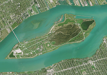
regional aerial imagery
SEMCOG has contracted with Nearmap who acquires imagery for the populated parts of the region 2-3 times per year. In addition to that, SEMCOG contracts with them to capture the entire region every 4 to 5 years. A SEMCOG member benefit includes an offline copy of the most recent imagery and a one-time discount on a subscription to Nearmap. Please click on the link below for more information.

Historic Imagery
SEMCOG has a large collection of Historic aerial imagery going back to 1949.
To acquire historic aerial imagery, send an email to SEMCOG’s Information Center ([email protected]) and include the following information:
- Name, email address, phone number
- Description of area of interest
- Flight year(s) in which you are interested.
Elevation Data
SEMCOG partnered with the State of Michigan to acquire LiDAR data captured in 2017. This LiDAR data is the primary source for deriving elevation models and other data sets. For more information about the LiDAR data, the products derived from it, and how to get a copy of the data, please refer to SEMCOG’s Elevation Quick Facts.
For more information on how LiDAR data is beneficial to county and local governments, see the following video.
Timestamps are in the video description and are as follows:
- 7:54 – Current state of LiDAR in the region
- 11:15 – The point cloud explained
- 22:51 – Derived datasets
- 27:49 – Urban Management
- 41:16 – Vegetation Management
- 45:26 – Summary & wrap up
- 46:24 – Q & A
For information about how to download the LiDAR data and the digital elevation model (DEM) derived from it, please see the Elevation Datasets for Southeast Michigan document. Elevation contours derived from the same LiDAR data can be found in SEMCOG’s Open Data Portal.
