Integrating Environmental Priorities into Transportation Planning
Healthy, attractive environmental assets, such as clean air and water, are essential to a thriving region. SEMCOG encourages transportation agencies to incorporate environmental priorities as part of the transportation planning process.

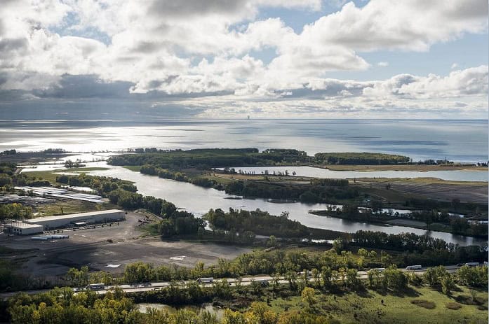
Photo: Plum Creek to Lake Erie
“A 2017 SEMCOG survey found that 63% of respondents agree that more spending should be directed to developing roadway infrastructure that minimizes water pollution and flooding.”
Green Infrastructure
Green infrastructure, both natural and constructed, can be strategically used along roadway corridors, to help mitigate stormwater runoff by reducing flooding and pollution affecting the regions water resources.
To learn more about the connections between the transportation system and the environment, see the resources below:
SEMCOG University Presentation: Transportation & Green Infrastructure
Great Lakes Green Streets Guide Book
LID Manual for Michigan
Regional Transportation Plan: Transportation & the Environment
I-75 Corridor Conservation Action Plan in Monroe County
The I-75 Corridor Conservation Plan integrates environmental priorities for the long-term reconstruction project.
This conservation action plan highlights the following:
- Partnerships and stakeholder involvement between multiple local, state, and federal agencies.
- Environmental priorities within the project area.
- Implementation strategies at the local and regional scale.
- Conservation planning actions for the I-75 reconstruction project.

Environmental Sensitivity Analysis
SEMCOG conducts an Environmental Sensitivity Analysis of planned transportation projects in the region.
- Environmentally sensitive resources generally include:
- Lakes and streams
- Designated trout lakes/streams
- Natural rivers
- Wellhead protection areas
- Sinkholes
- Wetlands, woodlands
An update to the Environmental Sensitivity Analysis is currently in the works. This update will including additional mapping, flooding risk scores, and new national wetland inventory data.
