SEMCOG
Southeast Michigan Council Of Governments
Menu

Home Archives for Brian Pawlik

Brian Pawlik

Brian Pawlik

Brian Pawlik is a bicycle and pedestrian planner at SEMCOG. He has a Masters in Urban Planning and a Bachelors in Geography and Urban Studies. Brian’s expertise includes nonmotorized and multi-modal connectivity, bicycle and pedestrian safety, TAP project development, and GIS.

bicycle and pedestrian travel
Two children wearing helmets ride bicycles on a paved path.

E-Bikes, E-Motos, and Managing an Emerging Safety Concern

Electric bicycles and other emerging electric mobility devices are becoming increasingly popular, especially among young riders, but not all are true e-bikes....
Brian PawlikSep. 24 2026
bicycle and pedestrian travel
Outdoor paved bike path with photo of map in bottom right corner

Biking through Different Environments

Biking is both a fun activity and an essential transportation option in Southeast Michigan, offering access to many everyday destinations. This video diary...
Brian PawlikFeb. 9 2026
bicycle and pedestrian travel
Street‑level crosswalk with bright pavement markings, pedestrian warning signs, and overhead signals for safer crossing.

Working Together to Eliminate Fatalities and Serious Injuries by 2050

Pedestrians, bicyclists, and motorcyclists are identified as the top-priority road users, reflecting a commitment to the safety of vulnerable groups.
Brian PawlikApr. 30 2024
data
Map interface showing speeding data across Detroit road corridors, with highlighted routes indicating locations where vehicles exceed speed limits

New Safety Tool Features Speed Data

SEMCOG has purchased historical vehicle speed data (2019-22) along with access to a new safety tool known as "ClearGuide Safety."
Brian PawlikAug. 8 2023
transportation
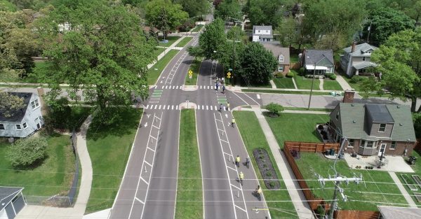
Aerial view of a residential neighborhood showing a multi‑lane road with marked bike lanes, crosswalks, sidewalks, lawns, and houses surrounded by trees.

Communities Utilize TAP Grants to Improve Transportation System

TAP provides communities with both federal funding and SEMCOG technical assistance to help make roadways more walkable, bikeable, and environmentally friendly.
Brian PawlikJan. 25 2022
bicycle and pedestrian travel
Aerial photograph showing a large multi‑lane roadway intersection with marked crosswalks, green bike‑lane sections, turn lanes, and traffic signals. Cars travel in multiple directions along the main thoroughfare, which is lined with commercial buildings including gas stations, small shops, and parking lots. Trees and residential areas appear in the background, creating a contrast between the busy roadway and the surrounding neighborhood.

What does a connected bicycle network really look like?

Experience the newly-installed protected bike lanes on Livernois Avenue and the newer bicycle facilities in Ferndale and Pleasant Ridge in this video.
Brian PawlikFeb. 3 2021
transportation
A recently reconstructed urban street is shown with wide, smooth pavement, landscaped medians filled with young trees and grasses, and clearly marked pedestrian crosswalks. The scene includes curb extensions, accessible sidewalk ramps, modern streetlights, and a mix of commercial buildings and parking areas along the roadway. A few vehicles travel down the center lanes under a partly cloudy sky, and the overall layout highlights stormwater‑friendly plantings and traffic‑calming design features.

Creating TAP Success through Partnerships

Each year, SEMCOG allocates TAP funding for transformative community projects that increase walkability, bikeability, and water quality.
Brian PawlikAug. 20 2020
bicycle and pedestrian travel
Several people move along a paved forest trail, with one riding a small bike and another holding a basketball among bare trees.

Activate Your Day and Month through Walking, Biking, and Other Active Transportation

In the face of adversity, people are celebrating active transportation at a micro-level in lieu of national, regional, or local events.
Brian PawlikMay. 13 2020
bicycle and pedestrian travel
Detailed map of existing and planned regional bike and pedestrian trails across Michigan highlighting sustainable transportation options.

Tools to Plan for Walking and Biking

Brian Pawlik highlights some new tools to assist your roadway and trailway planning efforts, courtesy of the new Bicycle and Pedestrian Mobility Plan.
Brian PawlikApr. 16 2020
SEMCOG| image:
  • Privacy Policy
  • Accessibility
  • Title VI
  • Titulo VI
  • الباب السادس

Helpful Links

  • Event Calendar
  • Regional Transportation Plan (RTP)
  • Metropolitan Affairs Coalition (MAC)
  • SEMCOG Publications
  • SEMCOG Universities
  • Freedom of Information Act

I want to…

  • Learn about SEMCOG Membership
  • See Data from My Community
  • See Maps of the Region
  • Find an Agenda/Meeting Minutes
  • Submit a Public Comment
  • Contact SEMCOG

Connect with us

1001 Woodward Avenue, Suite 1400
Detroit, Michigan 48226
(313) 961-4266
[email protected]
Media - (313) 580-6195

© 2026 SEMCOG | Built by LocalHop